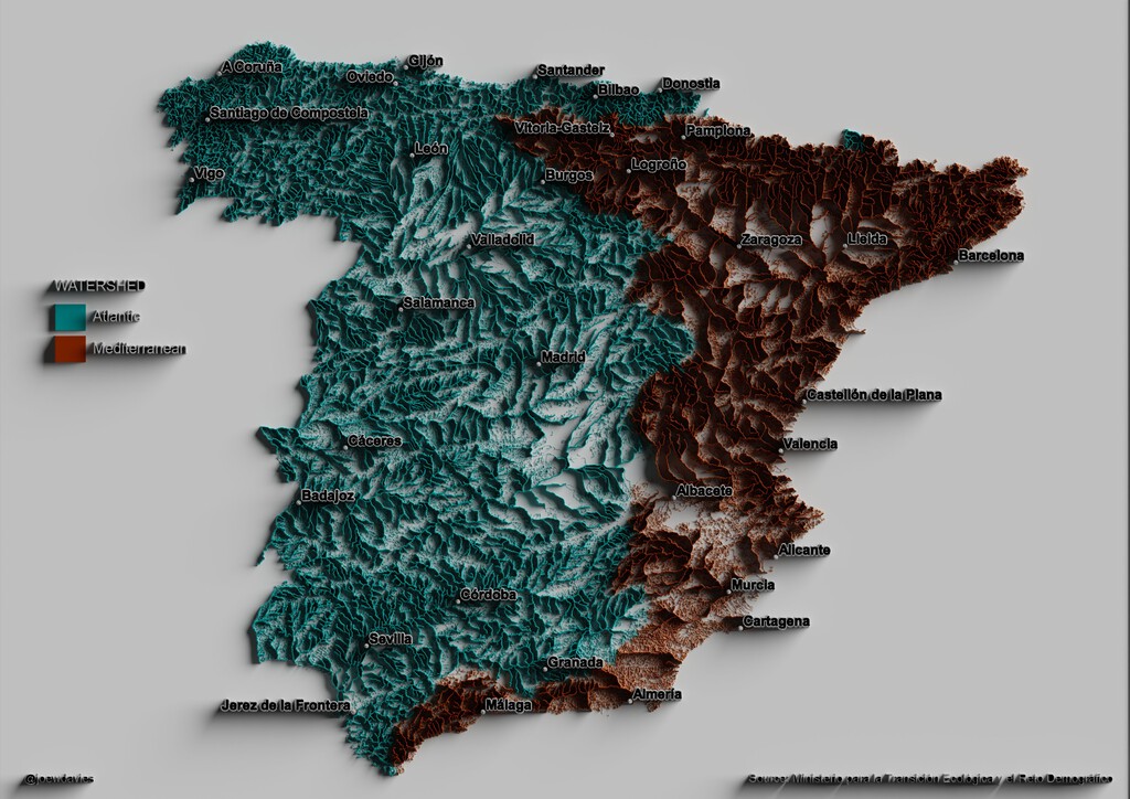
The Iberian Divide is a captivating map that splits Spain into two distinct hydrological worlds: river basins draining to the Atlantic Ocean and those flowing to the Mediterranean Sea. Created by cartographer Joe Davies using data from Spain's Ministry for Ecological Transition, this map reveals the invisible backbone of the peninsula—the continental divide.
This divide runs roughly along the Sistema Ibérico and the Pyrenean foothills, separating the territory into two major drainage systems. The map's striking colors and line thicknesses (indicating river flow) offer a powerful visual representation of Spain's hydrological reality.
Find Original Home Decor sparking conversation at Grand Goldman Shop.

What the Iberian Divide Map Shows
The map displays every river in peninsular Spain, color-coded by its final destination: blue for the Atlantic and red for the Mediterranean. The thickness of each line corresponds to the river's flow, highlighting the most voluminous waterways.
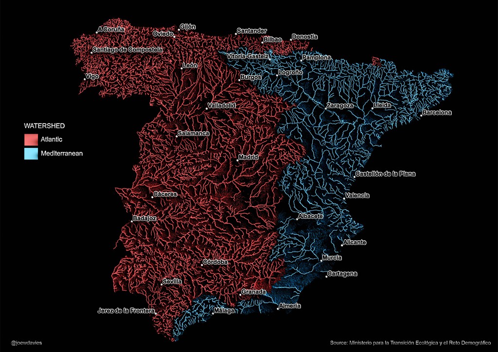
One of the most immediate observations is the proportion: the Atlantic basin covers approximately two-thirds of Spain's territory, while the Mediterranean basin accounts for the remaining third. This distribution might surprise those who associate Spain primarily with its Mediterranean coast.
Why the Atlantic Dominates Spain's Hydrology
Several factors contribute to the Atlantic's dominance. The Iberian Peninsula's topography, with major mountain ranges like the Pyrenees and the Sistema Ibérico, directs rainfall westward. Additionally, the Atlantic Ocean's influence brings moisture-laden winds that precipitate over the western and northern regions.
The map also reveals that despite Spain's Mediterranean coastline, the majority of its rivers flow westward. This has significant implications for water management, agriculture, and ecosystem health.
Key Takeaways from the Iberian Divide
- The Atlantic basin covers about two-thirds of Spain's land area.
- The continental divide runs along the Sistema Ibérico and Pyrenean foothills.
- River line thickness indicates flow volume, with major rivers like the Tagus and Ebro standing out.
- Despite its Mediterranean coast, Spain's rivers predominantly drain westward.
- The map underscores the importance of integrated water resource management.
Comparing the Two Basins
The Atlantic and Mediterranean basins differ not only in size but also in characteristics such as climate, river regime, and water demand. The table below summarizes key differences.
| Feature | Atlantic Basin | Mediterranean Basin |
|---|---|---|
| Approximate Area | Two-thirds of Spain | One-third of Spain |
| Major Rivers | Tagus, Douro, Ebro (partly) | Ebro, Júcar, Segura |
| Climate Influence | Atlantic, continental | Mediterranean |
| Typical Flow | Higher, more regular | Lower, more variable |
| Key Challenges | Pollution, over-abstraction | Scarcity, drought |
Implications for Water Management
The Iberian Divide highlights the stark contrast between Spain's water-rich west and water-scarce east. This imbalance poses challenges for water allocation, especially in the context of climate change and increasing demand from agriculture and tourism.
Understanding these hydrological boundaries is crucial for policymakers, as they inform decisions on infrastructure, such as reservoirs and transfers, and on conservation efforts. The map serves as a reminder of the need for sustainable water practices across both basins. The background to this story is set out in Europe's Great Divide: The Map Splitting the Continent's Watersheds. A related thread runs through Mediterranean Marine Heatwave Persists Across Basin After Summer. Earlier coverage in Energy Utilities: latest articles shows how the argument developed.
What to Watch Next
As climate change alters precipitation patterns, the Iberian Divide could shift, with potentially profound effects on both basins. Monitoring these changes will be essential for adapting water management strategies. A closer look at the same subject appears in Bidasoa River Salmon Face Rising Heat Threat in Navarra. Anyone following the wider picture can start with AMOC Weakening: 51% Slowdown by 2100 and Spain's Climate Impact. The same theme surfaces in Atlantic Salmon Crisis: Why Asturias Rivers Are Still Waiting, which takes a different angle.
Moreover, public awareness of these hydrological realities can foster greater appreciation for Spain's natural heritage and the need to protect its rivers. Context on how this played out before sits in Overtourism in Europe: Map Reveals Mediterranean Spain Hotspots.
FAQ
What is the Iberian Divide?
The Iberian Divide is the continental divide that separates the river basins draining to the Atlantic Ocean from those draining to the Mediterranean Sea in the Iberian Peninsula.
Why does the Atlantic basin cover more area?
Topography and prevailing winds direct most precipitation toward the Atlantic, resulting in a larger drainage area for the Atlantic basin.
How was the map created?
Cartographer Joe Davies used data from Spain's Ministry for Ecological Transition to map river basins, color-coding by destination and line thickness by flow.
Does the divide affect water availability?
Yes, it highlights the contrast between water-rich western regions and water-scarce eastern regions, influencing water management and policy.
Browse the Shop
 Acacia frida deluxe solid wood bed frame |
Bedroom bench |
Bed chest drawers |
Lingerie dresser |
Frame base |
Mirror with jewelry storage |
30 Bathroom Vanity |
Memory foam queen mattress |
Mattresses for back pain |
Nightstand set of 2 |
Grand Goldman Shop |
Civil Lawyer
Deutschland Trikot WM 2026