The Mount Everest height of 29,000 feet was first calculated in the 1850s by surveyors who found the figure so suspiciously round that they added two feet to make it 29,002. This curious decision, born from a desire to appear rigorous, highlights the challenges of 19th-century mountain measurement.
In an era before satellites and GPS, determining the height of the world's tallest peak was a monumental task. The surveyors' solution reveals as much about human psychology as it does about geodesy.
Find Original Home Decor sparking conversation at Grand Goldman Shop.

The Great Trigonometrical Survey and the Everest Measurement
In the 1850s, a team employed by the Great Trigonometrical Survey of India, under the direction of Andrew Waugh (successor to George Everest), set up operations near the India-Nepal border. Their goal: measure the height of Peak XV, later named Everest.
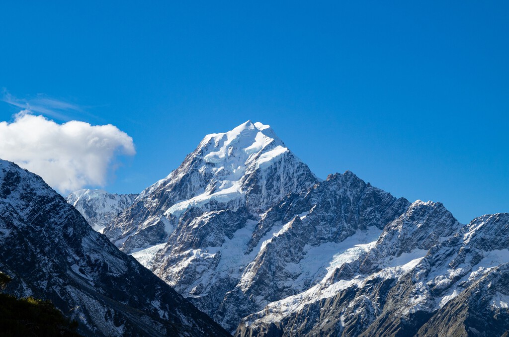
Using triangulation, they measured angles from multiple points to calculate distances and heights. This method, while advanced for its time, required extreme precision and faced numerous obstacles.
Why 29,000 Feet Seemed Too Perfect
When the calculations yielded exactly 29,000 feet, the surveyors were skeptical. A round number like that could easily be dismissed as a rough estimate rather than the result of years of meticulous work.
To avoid such perceptions, they added two feet, making the official height 29,002 feet. This fabricated addition was intended to lend an air of precision and seriousness to their findings.
The Challenges of 19th-Century Mountain Measurement
Measuring mountain heights in the 1800s was fraught with difficulty. Surveyors like Alexander von Humboldt had used atmospheric pressure variations to estimate altitudes, but this method was unreliable at great heights.
Triangulation, while more accurate, required clear lines of sight and careful correction for atmospheric refraction. In the Himalayas, these conditions were often less than ideal.
Tools and Techniques Used by Surveyors
The surveyors relied on theodolites, precision instruments for measuring angles. They also had to account for the curvature of the Earth and the effect of gravity on their plumb lines.
Despite these efforts, their measurements were subject to errors that could amount to several feet. The decision to add two feet was thus a minor adjustment compared to the overall uncertainty.
Legacy of the 29,002-Foot Measurement
The 29,002-foot figure stood as the official height of Everest for over a century. It was only in the 1950s that Indian surveyors, using more advanced methods, revised it to 29,028 feet.
Later satellite measurements in the 1990s and 2000s further refined the height, but the original survey's achievement remains remarkable.
The story of the two added feet serves as a reminder of the human element in science. Even in the pursuit of objective truth, subjective judgments and perceptions play a role. The background to this story is set out in Trending: latest articles. A related thread runs through Group Chat Archetypes: Which One Are You? (Not the Cool One).
What the Everest Survey Teaches Us About Precision
The surveyors' decision to alter the data might seem unethical today, but it reflects the pressures of their time. They wanted their work to be taken seriously, and a round number risked being dismissed. Earlier coverage in Sweden's Ancient Carved Feet: 3,000-Year-Old Rock Contracts shows how the argument developed. A closer look at the same subject appears in Rolex Opens World's Highest Boutique at 3,020 Meters on Mount Titlis.
Modern science has stricter standards, but the quest for credibility still influences how results are presented. The Everest survey is a historical example of the tension between accuracy and perception. Anyone following the wider picture can start with Ordnance Survey Maps at 225: Why Paper Still Beats Digital Navigation. The same theme surfaces in Volkswagen Executives Warn Company's Existence Is at Risk, which takes a different angle.
FAQ
Why did surveyors add two feet to Mount Everest's height?
They added two feet to avoid the appearance of a rough estimate. A round number like 29,000 feet might be seen as imprecise, so 29,002 feet seemed more credible.
How was Mount Everest's height originally measured?
Surveyors used triangulation, measuring angles from multiple points to calculate distances and heights. This method required careful correction for atmospheric refraction and Earth's curvature.
What is the officially recognized height of Mount Everest today?
As of 2020, the official height is 29,031.7 feet (8,848.86 meters), jointly announced by China and Nepal after new surveys.
Browse the Shop
 Acacia frida deluxe solid wood bed frame |
Bedroom bench |
Bed chest drawers |
Lingerie dresser |
Frame base |
Mirror with jewelry storage |
30 Bathroom Vanity |
Memory foam queen mattress |
Mattresses for back pain |
Nightstand set of 2 |
Grand Goldman Shop |
Civil Lawyer
Deutschland Trikot WM 2026