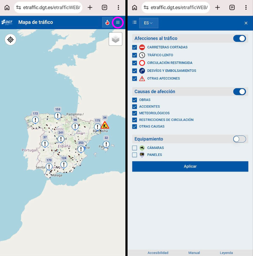
The DGT traffic map is the most reliable tool for checking real-time road conditions in Spain, offering official data that outperforms crowd-sourced apps like Google Maps and Waze. As summer brings a surge in road trips, having accurate information about incidents, closures, and traffic jams is essential for a smooth journey.
Why the DGT Traffic Map Stands Out
Unlike Google Maps and Waze, which rely on user reports and GPS data from other drivers, the DGT map is fed directly by the Dirección General de Tráfico (DGT). This means it uses official sources such as traffic cameras, aerial surveillance, and patrols from the Guardia Civil's traffic unit. As a result, the information is often faster and more precise.
Find Original Home Decor sparking conversation at Grand Goldman Shop.

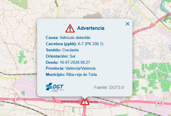
For example, the DGT map can tell you exactly when a traffic jam started, when an accident occurred, and even how many lanes are blocked. This level of detail is invaluable for planning alternative routes or adjusting your travel time.
How Google Maps and Waze Compare
Google Maps and Waze are excellent for turn-by-turn navigation and provide real-time traffic updates based on user input. However, their data can sometimes lag or be less accurate because they depend on crowdsourcing. If another driver reports an accident, it may take a few minutes for the app to reflect it. In contrast, the DGT map updates directly from official sources, ensuring you get the most current information.
That said, both apps are still highly useful for route guidance and estimating travel times. The key is to use them in conjunction with the DGT map for a comprehensive view of road conditions.
Key Features of the DGT Traffic Map
- Real-time incidents: Accidents, road closures, construction, and other disruptions are displayed promptly.
- Official data: Information comes from DGT's network of cameras, aerial systems, and traffic officers.
- Detailed lane information: Know exactly how many lanes are affected by an incident.
- Historical data: See when a traffic jam began or when an accident was reported.
- Free and accessible: The map is available online and requires no download.
When to Use the DGT Map
The DGT map is particularly useful during peak travel times, such as summer weekends, holidays, and long weekends. It's also essential for checking conditions before setting off on a long journey, especially if you're driving through areas prone to congestion. The longer history behind the story is traced in DGT Traffic Map: The Most Reliable Road Tool for Spain.
If you're planning a road trip, make it a habit to check the DGT map alongside your usual navigation app. This dual approach ensures you're not caught off guard by sudden closures or accidents. The background to this story is set out in Spain's DGT Warns: Total Solar Eclipse Traffic Chaos on August 12. A related thread runs through Super Nature Review: Crowd-Sourced Super 8 Film Celebrates Wildlife. Earlier coverage in Car: latest articles shows how the argument developed.
Comparison: DGT Map vs. Google Maps vs. Waze
| Feature | DGT Map | Google Maps | Waze |
|---|---|---|---|
| Data source | Official DGT sources (cameras, officers) | User reports + GPS data | User reports + GPS data |
| Real-time accuracy | High (direct from authorities) | Moderate (depends on user input) | Moderate (depends on user input) |
| Lane closure details | Yes | Limited | Limited |
| Turn-by-turn navigation | No | Yes | Yes |
| Incident start time | Yes | Sometimes | Sometimes |
Practical Tips for Using the DGT Map
Before you hit the road, open the DGT map on your phone or computer. Check for any incidents along your route and identify alternative paths if needed. During your journey, you can ask a passenger to monitor the map for updates, or safely pull over to check it if necessary. A closer look at the same subject appears in Madrid A-5 Tunnel Works: Traffic Chaos and What to Expect. Anyone following the wider picture can start with YouTuber Finds Two Abandoned Ferrari F40s on Google Maps: The Real Story. The same theme surfaces in Spain's Speed Cameras: Legal Margins That Can Save You a Fine, which takes a different angle.
Remember that the DGT map is a web-based tool, so you'll need an internet connection to access it. It's also available in Spanish, but the interface is intuitive enough for non-Spanish speakers to navigate. Context on how this played out before sits in Waze brings a feature that will make you forget about Google Maps. A companion piece, Google Opens SynthID AI Detection Tool to All, But Is It Reliable, approaches the same subject from another angle.
FAQ
Is the DGT traffic map free to use?
Yes, the DGT traffic map is completely free and accessible online. You don't need to download an app or create an account.
Can I use the DGT map for navigation?
No, the DGT map is not a navigation app. It provides real-time traffic information but doesn't offer turn-by-turn directions. Use it alongside Google Maps or Waze for navigation.
How often is the DGT map updated?
The DGT map is updated in real-time as incidents are reported by official sources. This means you'll see the most current information available.
Does the DGT map cover all of Spain?
Yes, the DGT map covers the entire Spanish road network, including highways, secondary roads, and urban areas.
While Google Maps and Waze are great for getting from point A to point B, the DGT traffic map is the ultimate tool for accurate, real-time road information in Spain. By using it in combination with your favorite navigation app, you'll be better prepared for any journey.
Browse the Shop
 Acacia frida deluxe solid wood bed frame |
Bedroom bench |
Bed chest drawers |
Lingerie dresser |
Frame base |
Mirror with jewelry storage |
30 Bathroom Vanity |
Memory foam queen mattress |
Mattresses for back pain |
Nightstand set of 2 |
Grand Goldman Shop |
Civil Lawyer
Deutschland Trikot WM 2026