In 1974, France completed the Lac du Der-Chantecoq, a massive artificial reservoir designed to prevent Paris from flooding again. The solution was radical: three villages were erased from the map to create a 48 km² lake capable of holding 350 million cubic meters of water.
The story begins with the devastating flood of 1910, when the Seine rose to 8.62 meters at the Austerlitz bridge, turning Parisian streets into canals and forcing residents to navigate by boat. That disaster spurred France to seek a way to control the river's flow upstream.
Find Original, High-end Home Decor that spark conversation at Grand Goldman Shop.
The Threat of the Marne and Seine
The problem wasn't just the Seine. The Marne River joins the Seine before it reaches Paris, and its floods could significantly raise water levels in the capital. After major floods in 1910 and 1924, France developed a network of upstream reservoirs to hold back excess water before it reached the Paris region.
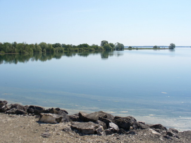
The largest of these would be built in the humid Champagne region: the future Lac du Der-Chantecoq. Construction began in 1967 and completely transformed the landscape. When the reservoir opened in 1974, it had 77 kilometers of shoreline and could store up to 350 million cubic meters of water.

How the Reservoir Works
The Lac du Der functions like a giant buffer. During periods of heavy rain, it captures water from the Marne and its tributaries, preventing it from rushing toward Paris. In drier times, the stored water is gradually released to maintain a stable river level.
This system helps avoid the kind of catastrophic flooding that struck in 1910. The reservoir can significantly reduce peak flows, protecting the capital and its surroundings. It's a key part of France's flood management strategy, which includes several other reservoirs in the Seine basin.
The Human Cost: Three Villages Lost
Creating such a large reservoir required sacrifice. Three villages—Chantecoq, Champaubert-aux-Bois, and Nuisement-aux-Bois—were submerged. Their residents had to relocate, and the government compensated them for their lost homes and land.
The church of Champaubert-aux-Bois was dismantled stone by stone and rebuilt in a nearby village. Today, a cross marks the spot where the original church stood, a poignant reminder of the communities that once thrived there.
The reservoir also covered forests and farmland, permanently altering the local ecosystem. However, the lake has since become an important habitat for migratory birds, particularly cranes, and a popular recreational area.
Key Facts About Lac du Der
- Surface area: 48 km² (18.5 sq mi), one of the largest artificial lakes in Europe.
- Capacity: 350 million cubic meters of water.
- Shoreline: 77 km (48 mi) with beaches and observation points.
- Purpose: Flood control for Paris and the Seine valley.
- Construction: Began in 1967, inaugurated in 1974.
- Villages submerged: Chantecoq, Champaubert-aux-Bois, Nuisement-aux-Bois.
Comparison with Other Flood Control Reservoirs
| Reservoir | Year Completed | Capacity (million m³) | Surface Area (km²) |
|---|---|---|---|
| Lac du Der-Chantecoq | 1974 | 350 | 48 |
| Lac d'Orient | 1966 | 205 | 23 |
| Lac Amance | 1990 | 50 | 5 |
| Lac de la Forêt d'Orient | 1966 | 205 | 23 |
These reservoirs work together to regulate the Seine's flow. The Lac du Der is the largest and most critical for preventing major floods in Paris.
Environmental and Economic Impact
While the reservoir was built for flood control, it has become a hub for biodiversity. The lake's shallow waters and surrounding wetlands attract thousands of migratory birds, including common cranes. It's now a Natura 2000 site, protected for its ecological value. Context on how this played out before sits in Lac du Der: The Artificial Lake That Flooded Three French Villages.
The lake also supports local tourism, with activities like sailing, fishing, and birdwatching. The economic benefits have helped offset the loss of agricultural land and villages. The background to this story is set out in Nepal and Tibet Flood Aid Race: Lake Burst Threat Looms. A related thread runs through Tibet Flood Damage Assessment Hampered by China's Information Control.
What to Watch Next
Climate change is altering rainfall patterns in France, potentially increasing the risk of both floods and droughts. The Lac du Der will continue to play a vital role in managing these extremes. Authorities regularly monitor and maintain the reservoir's infrastructure to ensure it functions effectively. Earlier coverage in Energy Utilities: latest articles shows how the argument developed. A closer look at the same subject appears in Bilbao Port Hydrogen Pipeline: 38 km Tube to Connect Cantabrian Coast.
As Paris grows and the climate shifts, the balance between water storage and release will become even more crucial. The lessons from 1910 and the creation of Lac du Der remind us of the lengths societies will go to protect themselves from natural disasters. Anyone following the wider picture can start with Artificial Glaciers in Ladakh: The Ice Stupa Revolution. The same theme surfaces in Argentina's Perfect Circular Floating Island El Ojo Explained, which takes a different angle.
FAQ
Why was Lac du Der built?
Lac du Der was built to prevent severe flooding in Paris by storing excess water from the Marne River. It was a response to the catastrophic floods of 1910 and 1924, which caused significant damage in the capital.
Which villages were submerged to create Lac du Der?
Three villages were submerged: Chantecoq, Champaubert-aux-Bois, and Nuisement-aux-Bois. Residents were relocated, and some structures, like the church of Champaubert-aux-Bois, were rebuilt elsewhere.
How does Lac du Der help control floods?
The reservoir captures water during heavy rains, reducing the flow that reaches Paris. It can hold up to 350 million cubic meters, significantly lowering peak river levels downstream.
Can you visit Lac du Der today?
Yes, the lake is open to the public and offers recreational activities such as sailing, fishing, and birdwatching. It is also a protected area for migratory birds.
Browse the Shop
 Acacia frida deluxe solid wood bed frame |
Bedroom bench |
Bed chest drawers |
Lingerie dresser |
Frame base |
Mirror with jewelry storage |
30 Bathroom Vanity |
Memory foam queen mattress |
Mattresses for back pain |
Nightstand set of 2 |
Grand Goldman Shop |
Civil Lawyer
Deutschland Trikot WM 2026