An interactive map of all 140 Spanish lighthouses has been created by cartographer Aaron Becker as part of his Mapped Earth project. The map displays Spain's coastline in darkness, illuminated only by the rhythmic flashes and rotating beams of each lighthouse, accurately mimicking their real-life light patterns.
This isn't just a pretty visualization: in the real world, each lighthouse's unique flash pattern allows sailors to identify their location along the coast. The map brings that navigational aid to life, offering a stunning and educational view of Spain's maritime heritage.
Find Original, High-end Home Decor that spark conversation at Grand Goldman Shop.
What the Map Shows
The map covers the entire Spanish coastline and includes 140 lighthouses. Of these, 91 are rotating, 49 are fixed, and 30 have colored sectors. When you zoom in, you can see the lighthouses in greater detail, including the 3D nighttime relief of the surrounding area.
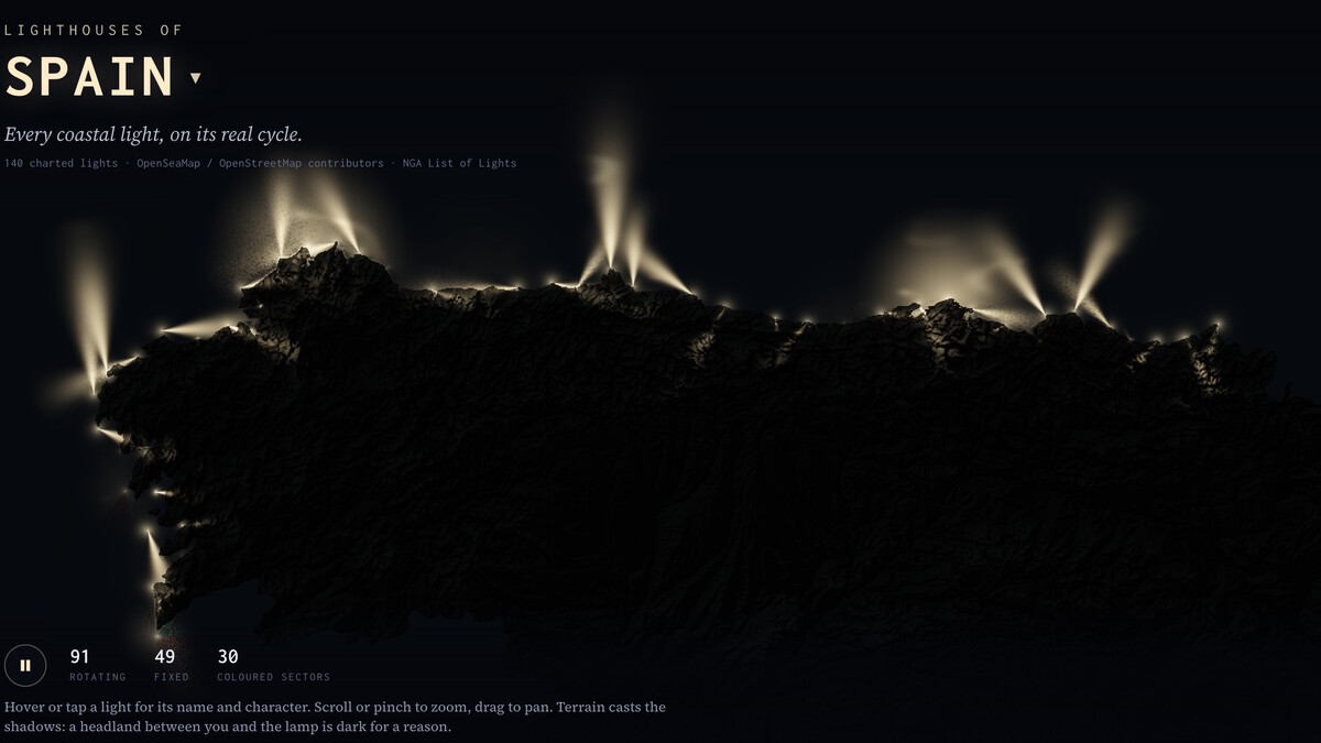
The map is part of Mapped Earth, which features similar interactive maps for 27 other countries. Each map is built using data from OpenSeaMap and OpenStreetMap, combined with the NGA List of Lights, the official list of navigational aids from the U.S. National Geospatial-Intelligence Agency. This list is a standard reference for nautical charts worldwide.
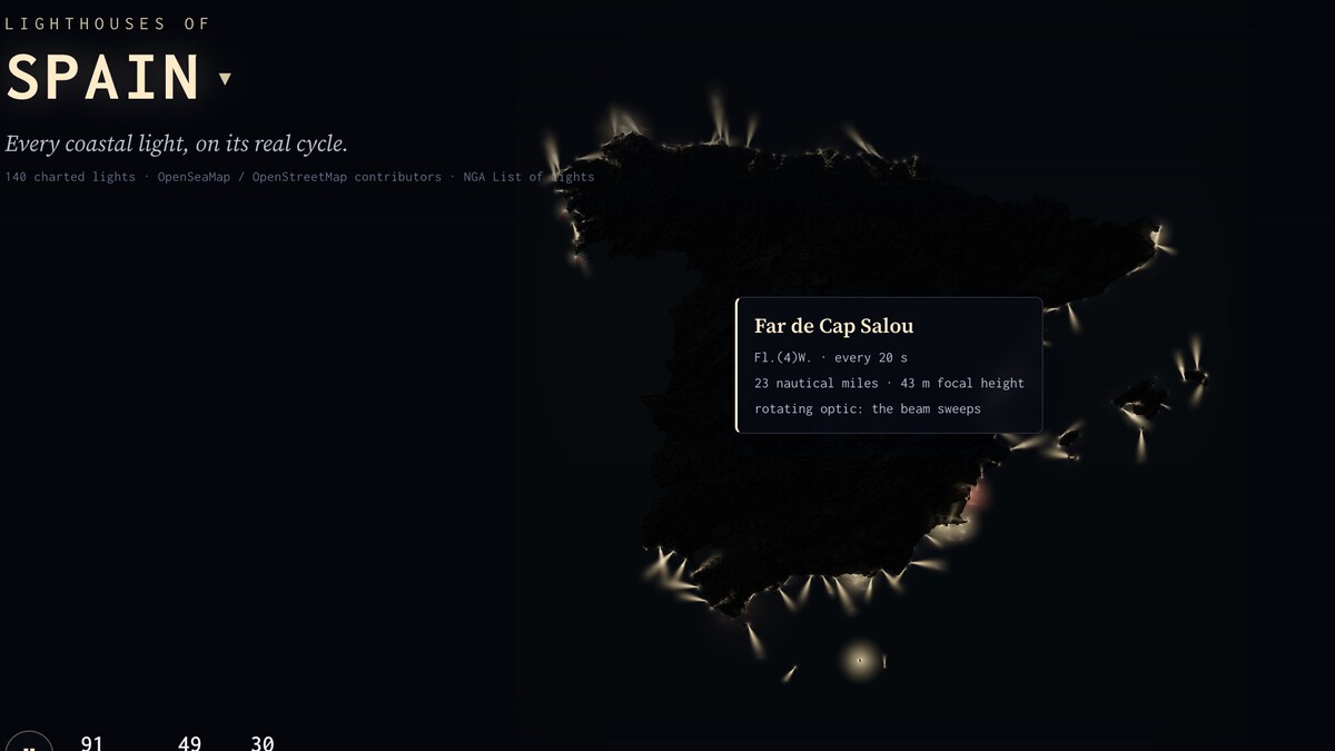
How the Map Works
Each lighthouse on the map uses the International Association of Marine Aids to Navigation and Lighthouse Authorities (IALA) code to represent its light pattern. The map also projects shadows from the terrain, just as they would appear in reality, adding depth and realism.
The interactive nature of the map allows you to see how each lighthouse flashes or rotates at its real rhythm. This is particularly useful for understanding how mariners use these patterns to navigate. For example, a lighthouse with a group of three flashes every 10 seconds tells a sailor exactly which point of the coast they are passing. The longer history behind the story is traced in Roman Theater in Málaga Unearthed After 35 Years: Seating Found Intact.
Why It Matters
Lighthouses have been crucial for maritime safety for centuries. Even in the age of GPS, they serve as backup and visual confirmation for sailors. This map celebrates that heritage and provides a new way to appreciate these iconic structures. Context on how this played out before sits in Wuzhen: China's Water Town That Became a Silk Road Hub. A companion piece, Interactive Map Shows All 140 Spanish Lighthouses in Real Time, approaches the same subject from another angle.
Spain's coastline is dotted with lighthouses, each with its own history and characteristics. The map highlights the diversity of these aids to navigation, from the rotating beams of major ports to the fixed lights of smaller harbors. It's a valuable resource for maritime enthusiasts, historians, and anyone interested in cartography. The background to this story is set out in Spain's 3D Castle Map: Explore 132 Fortresses in Stunning Detail. A related thread runs through Trending: latest articles.
Key Features of the Interactive Map
- Displays all 140 Spanish lighthouses with accurate light patterns.
- Interactive zoom reveals 3D nighttime relief and detailed views.
- Uses official data from OpenSeaMap, OpenStreetMap, and the NGA List of Lights.
- Includes lighthouses from 27 other countries for comparison.
- Shows rotating, fixed, and colored sector lights.
Comparison of Lighthouse Types in Spain
| Type | Count | Description |
|---|---|---|
| Rotating | 91 | Lights that rotate, creating a flashing effect visible from different directions. |
| Fixed | 49 | Lights that shine steadily in all directions or in a fixed sector. |
| With colored sectors | 30 | Lights that show different colors to indicate safe water or hazards. |
What to Watch Next
Aaron Becker continues to expand Mapped Earth with new countries and data layers. The project demonstrates the power of open data and creative visualization to make complex information accessible and engaging. Earlier coverage in Playa del Ruso: The Hidden Granada Beach Named After a Mysterious Russian shows how the argument developed. A closer look at the same subject appears in The Only Underwater Submarine Kill in History: HMS Venturer vs U-864.
As more countries are added, the map could become a comprehensive tool for understanding global maritime navigation. For now, the Spain map offers a captivating glimpse into the country's coastal heritage. Anyone following the wider picture can start with Why Cats Choose the Person Who Ignores Them. The same theme surfaces in Spain's New Traffic Rules Let Bikes Ride Against One-Way Traffic, which takes a different angle.
FAQ
What is the interactive lighthouse map of Spain?
It is a digital map that shows all 140 Spanish lighthouses with their real-life light patterns, created by Aaron Becker as part of Mapped Earth.
How many lighthouses are in Spain?
The map displays 140 lighthouses along the Spanish coastline, including 91 rotating, 49 fixed, and 30 with colored sectors.
What data sources were used for the map?
The map uses data from OpenSeaMap, OpenStreetMap, and the NGA List of Lights, the official navigational aid list from the U.S. National Geospatial-Intelligence Agency.
Can I see other countries on the map?
Yes, Mapped Earth includes similar maps for 27 other countries, each with their own lighthouses and navigational aids.
Browse the Shop
 Acacia frida deluxe solid wood bed frame |
Bedroom bench |
Bed chest drawers |
Lingerie dresser |
Frame base |
Mirror with jewelry storage |
30 Bathroom Vanity |
Memory foam queen mattress |
Mattresses for back pain |
Nightstand set of 2 |
Grand Goldman Shop |
Civil Lawyer
Deutschland Trikot WM 2026