China's invisible ocean map is quietly reshaping the strategic balance beneath the waves, and it could strip away the last tactical advantage the United States held in undersea warfare. More than 80% of the planet's oceans remain unmapped in detail, and in many regions we know less about the seafloor than about the surface of the Moon. Yet that unknown environment is critical to some of the world's most advanced technologies.
According to a recent Reuters report, Beijing has spent years charting the ocean floor across the globe. When the effort is complete, China may know the terrain of the world's most silent battlefield better than anyone else.
Find Original Home Decor sparking conversation at Grand Goldman Shop.

Why the Invisible Ocean Map Matters
For decades, American undersea superiority rested not only on more advanced submarines but on something far less tangible: deep knowledge of the ocean environment. That balance is now beginning to shift as Beijing builds a detailed picture of the invisible world that shapes every move underwater.
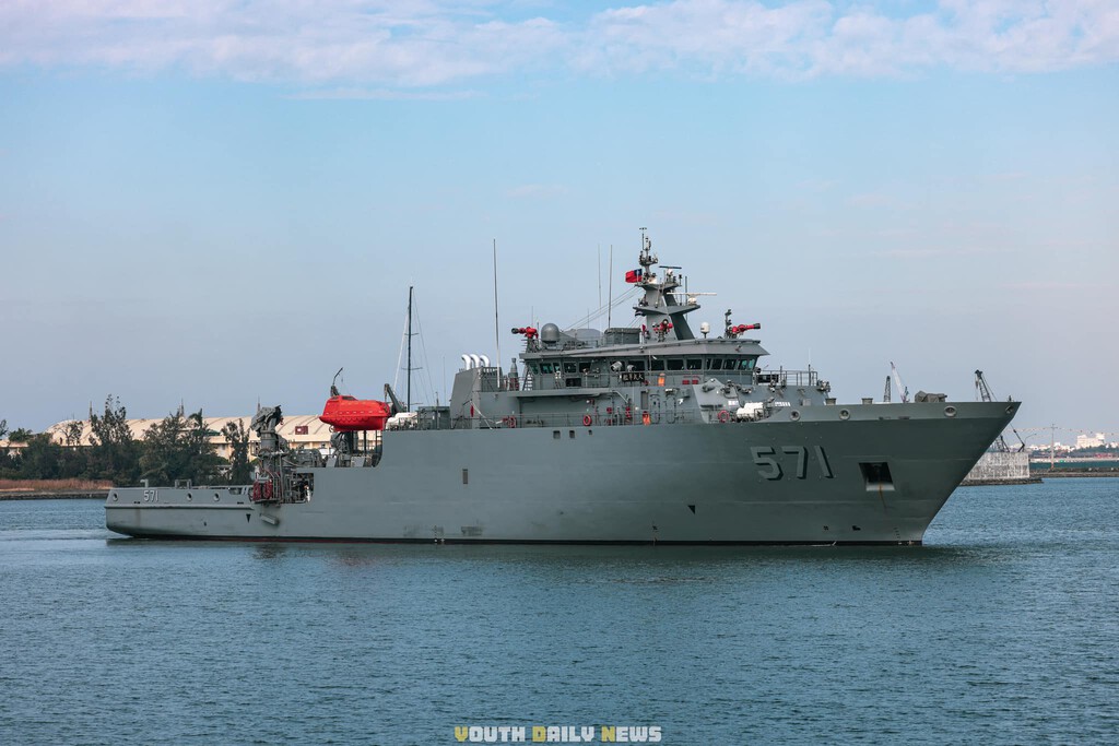
Submarine warfare depends on far more than hull design. Temperature layers, salinity gradients, and currents determine how sound travels through water and whether a vessel can be detected. A nation that understands those conditions better can hide more effectively and hunt more precisely.
A Global Network of Ships and Sensors
What looks at first glance like oceanographic research is in fact a global-scale operation. It combines dozens of vessels, hundreds of sensors, and years of accumulated data across the Pacific, Indian, and Arctic oceans.
These ships run repeated routes, scanning the seabed and gathering key information on temperature, salinity, and currents. Those factors govern how sound propagates underwater, which is the foundation of sonar and anti-submarine warfare.
- Dozens of survey vessels operate across multiple oceans on repeated routes.
- Hundreds of sensors collect temperature, salinity, and current data.
- Years of accumulated records build a detailed picture of undersea conditions.
- Better environmental data directly improves submarine detection and evasion.
- More than 80% of the ocean floor remains unmapped in detail.
From Research to Strategic Advantage
The line between civilian oceanography and military advantage is thin. Seabed maps and water-column data serve science, shipping, and resource exploration, but they also feed the models that navies use to plan undersea operations.
China's effort is notable for its scale and persistence rather than any single breakthrough. Repeated surveys of the same routes gradually refine the data, turning scattered readings into a coherent model of the undersea environment.
What the Data Actually Reveals
Temperature and salinity profiles determine how sound bends through the water. Currents and seabed topography shape where submarines can travel and where they can hide. A nation with superior data can choose routes and depths that exploit those conditions.
That is why the United States treated ocean knowledge as a strategic asset for so long. It was not a single system but a accumulated understanding that made every other system more effective.
How the Balance Is Changing
The shift does not happen overnight. It emerges as China's dataset grows and as its survey fleet covers more of the Pacific, Indian, and Arctic oceans. Each completed route adds detail that was previously missing.
| Factor | United States (historical) | China (emerging) |
|---|---|---|
| Undersea data depth | Decades of accumulated records | Rapidly expanding global surveys |
| Survey reach | Concentrated in key strategic zones | Pacific, Indian, and Arctic oceans |
| Submarine technology | Advanced and proven | Improving steadily |
| Environmental modeling | Mature | Growing with each survey cycle |
| Strategic effect | Detection and stealth advantage | Narrowing the knowledge gap |
Who Is Affected and What to Watch
The implications reach beyond the two rivals. Allies that rely on US undersea dominance for maritime security will feel any erosion of that advantage. Shipping lanes and resource claims also depend on accurate seabed knowledge.
What to watch next is whether China's survey fleet expands into new regions and whether the United States responds with its own mapping push. The race is less about ships than about data, and data compounds over time.
Understanding how strategic resources drive rivalry helps frame the bigger picture. The same pattern of long-term investment appears in China's 582-ton magnet for artificial sun fusion energy, where patient buildout aims to leapfrog rivals in a completely different domain. The background to this story is set out in China Uses US-Funded Pacific Sensors to Find Invisible Ocean Structures. A related thread runs through Scientists Discover Ocean Missing Plastic Became Invisible Nanoplastics. Earlier coverage in Microsoft Quietly Retires Copilot+ PC Brand for New Surface Models shows how the argument developed.
Both efforts show a willingness to commit resources over years rather than months. That patience is what makes the ocean mapping campaign so significant, because the advantage it builds is cumulative and hard to reverse quickly. A closer look at the same subject appears in Underwater Robot to Clean Spain's Seabed of Marine Litter. Anyone following the wider picture can start with Trending: latest articles. The same theme surfaces in China's Hailong Buoys: Mini Data Centers for Ocean Monitoring, which takes a different angle.
The undersea balance will not be decided by a single event. It will be decided by who understands the invisible ocean best when it matters most, and that contest is already underway. Context on how this played out before sits in China's New Y-9 Anti-Submarine Aircraft Targets Undersea Weakness. A companion piece, Disney Concert Hall's Heat Glare: A Lesson in Urban Design, approaches the same subject from another angle.
FAQ
What is China's invisible ocean map?
It refers to China's long-running effort to chart the global seafloor and collect data on temperature, salinity, and currents. That data supports oceanographic research but also improves undersea military planning.
Why does ocean mapping matter for submarines?
Water conditions determine how sound travels, which affects sonar detection and evasion. Better environmental data lets a navy choose routes and depths that improve stealth or hunting effectiveness.
How much of the ocean is still unmapped?
More than 80% of the planet's oceans remain unmapped in detail. In many areas, knowledge of the seafloor is less complete than knowledge of the Moon's surface.
What advantage could the US lose?
The United States has long relied on superior knowledge of the undersea environment as much as on advanced submarines. As China's dataset grows, that knowledge edge narrows.
Browse the Shop
 Acacia frida deluxe solid wood bed frame |
Bedroom bench |
Bed chest drawers |
Lingerie dresser |
Frame base |
Mirror with jewelry storage |
30 Bathroom Vanity |
Memory foam queen mattress |
Mattresses for back pain |
Nightstand set of 2 |
Grand Goldman Shop |
Civil Lawyer
Deutschland Trikot WM 2026